The Size of the Earth Project
 |
Fifth grade students from Holton-Arms in Bethesda, Maryland and Liceo Benalcazar in Cali, Colombia completed a science project to measure the size of the Earth. The goal of the project was to establish links among young students in an international setting in order to team up to solve a problem. The challenge given to the students was to reproduce the measurement of the size of the Earth made more than 2,000 years ago by the ancient Greeks. To accomplish the task students in the two cities were instructed to simultaneously measure the length of the shadow cast by a stick when the Sun is at its highest elevation over the horizon.
Eratosthenes (273 - 194 BC) knew that if the Earth was flat the length of the shadows would be the same, whereas if the Earth was round the sticks would project shadows of different length because they would be inclined relative to the direction of the Sun at different angles. Applying concepts of basic geometry the students combined and analyzed the measurements made from the two cities and obtained results of remarkable precision. The students were able to determine the circumference of the Earth (40,000 Km) with an error of only 7%.
| Photos | Results | Background | Material |
The Eratosthenes challenge for IYA2009
|
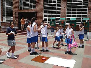
Pictures from the Measurements at Liceo Benalcazar
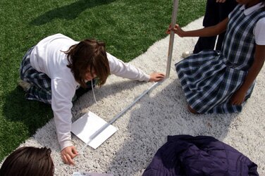
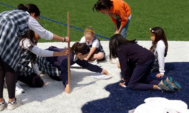
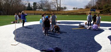
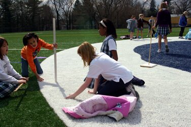
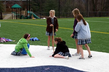
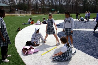
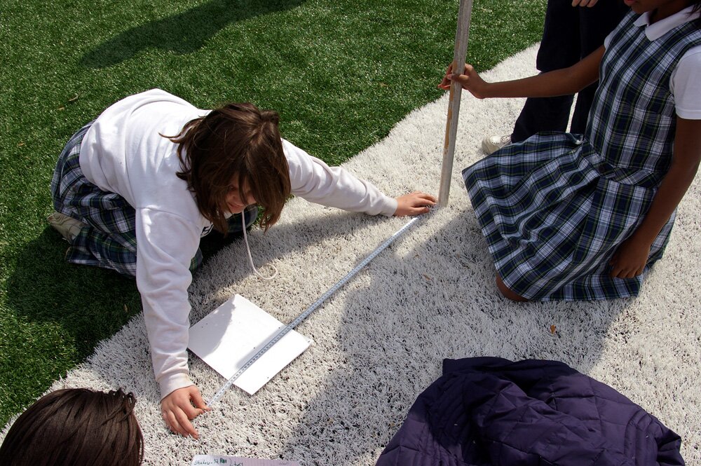
Pictures from the Measurements at Holton-Arms
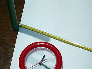
(Note that the shadows are significantly longer than those from Cali.
That's because the Earth is round! If the Earth was flat the shadows would be the same length)
Summary of Experiment and Results
On March 10 and 11 at 12:20 pm the students in Bethesda and Cali measured the length of the shadow cast by a stick one meter long.
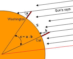
Whereas in Bethesda the length of the shadow was 92 cm, in Cali it was 13 cm (see photos). With the known length of the stick (1 m) and the shadows the students determined that the angle between the two cities as seen from the center of the Earth (see diagram below) is 35 degrees.
To compute the circumference of the Earth the students worked with a model of the Earth similar to that of a pizza cut in slices of equal size. In this model a ‘slice’ of the Earth is formed by the lines joining the locations of the two cities with the center of the Earth. Since the circle has 360 degrees there will be 360/35 = 10.3 slices. Thus if the length of the arc of one slice is known (that would be the Cali-Washington distance) then the total circumference of the pizza is simply the product of the number of slices by the length of the side of each slice.
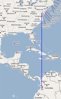
To estimate the Cali-Washington distance they used a mosaic of (distance preserving) maps from an atlas. They measured the distance directly over the maps with a ruler, and used the scale of the map to get the actual distance in Kilometers. It is important to note that for the method to work the two cities must be in the same meridian, which is the case for Washington and Cali. The actual Cali-Washington distance is 3,936 Kilometers.
When averaging the results the final number for the circumference comes to 40,231 Km, which is very close to the actual value of 40,008 Km (using the average Earth radius. The shape of the Earth is that of an oblate spheroid). The measurement error is estimated to be 7%.
This project was a source of great educational opportunities. Highlights include:
- Students learned that a tremendously complex and large object as is our planet is subject to measurement by simple means (all within their reach). To be able to see the effects of the curvature of the Earth they needed to collaborate with ‘colleagues’ in a remote country.
- With actual measurements in the field followed by analysis in the classroom, students experienced first hand the nuanced and, at times, tricky business of scientific research. The girls realized that even the most careful of measurements is subject to errors. They also learned to connect measurement with theory (i.e. a model of the round Earth).
- They were able to apply the geometry and math learned in class in solving ‘real life’ problems.
- The experience provided the students with an opportunity to engage in problem solving activities with students from another country, an accomplishment of immense value in these times of global challenges.
Detailed analysis document
Project Background
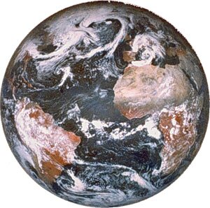 |
Measuring the Earth has been a scientific activity of tremendous importance for the development of human kind. The world economy has seen huge benefits every time we enhance our knowledge about the planet. Think of the English clockmaker John Harrison and his work in the 18th century when he solved the problem of determining longitude at sea. Or, citing a more recent example, GPS technology (a $22 billion dollar industry) is possible thanks to a detailed model of the Earth. |
| The cities of Cali and Washington D.C. are aligned in the same meridian. This geographical fact is being exploited by students in the two cities to measure the size of the Earth. Fifth grade students of Holton-Arms and Liceo Benalcazar are working together on this project. Establishing links among young students in an international setting is an essential component of the skills set that this and future generations will need to posses in order to meet global challenges. |
 |
 |
The goals of the project are met by using simple geometry and inexpensive methods to measure the shadow cast by a stick on the ground. These measurements take place simultaneously in both cities. The technique was invented by Eratosthenes (276 - 194 BC) who made the most accurate measurements (only 0.7% error!!) of the size of the Earth in ancient Greece. |
Project Material
In English
- More about Eratosthenes
- Excerpt about Eratosthenes measurements from the book "Measuring the Universe" by Kitty Ferguson
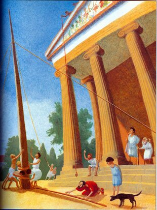
- "Eratosthenes: The Librarian who Measured The Earth" by Kathryn Lasky, with illustrations Book excerpt
- Teacher's guidelines
- Instructions for students
- Sample analysis
- Detailed analysis document
|
En Español
|
For additional information please contact:
